

SOLUTIONS for Water Districts across the Philippines
Working hand-in-hand with water district managers and engineers the tools for improving the operational cost and efficiencies are being formulated. We have found the area of greatest need is the smaller Water Districts where the for a cost effective sustem is equally important as the cities. Working in groups a formula is developing where the larger communities have the capacity to share resources with the smaller ones. This is the sharing of engineering expertise will be a valuable asset. Elliott Enterprises utilizing international consultants are developing a system to assist in working smarter with less resources can be achieved.
The core requirement in developing an efficient water distribution are discussed as follows:
COLLECTING DATA
First step is to develop a map of the evisting system and all components. It is important to collect the data at the hiest accuracy posible as allwater sytems are reliant on the relative height of the suyste: the data must be referenced to a common point. Hydraulic engineering is all relative to delivery head, flow and pressure. This is an exact science.
Elliott Enterprises are experts in supply and installation of Static Base GNSS Surveying systems.

GROUND PENETRATING RADAR (GPR)
A new product has been added to our product range – GPR

The RADAR SYSTEMS Zond-12e Utility Mapper provides Water District Engineers a view underground. Using Ground Penetrating Radar Pipeline networks can be mapped. Observing the location of pipes and infrastructure in real-time. Depth of pipes can be added to network surveying further improving accuracy. GPR is ideal for locating and identifying the exact location of bursts and leaks in deep buried pipes making excavation a more exacting process. Saving time and money.


AUDITING FIELD DATA
The field data is automatically transferred to Carlson Civil desktop software from Carlson SurvPC on the field computer.


GOOGLE EARTH REVIEW
Google Earth data format export from Carlson Civil provides a simple reporting medium for engineers and management.
Google Earth plays an important role. Field GIS and position data exported directly to Google Earth allowing engineers to present existing designs, concepts and progress results in a form easily presented for reporting using simple but complete maps. This process was previously a difficult but sought after tool.

TRANSFERING THE NETWORK AS-BUILT TO EPANET HYDRAULIC SOFTWARE
There are several conversion software available to take the CAD design to EPANET data format. Elliott Enterprises technical staff have chosen the one performing the task with ease.

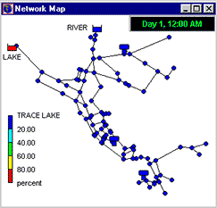
The central component in the process will be the EPANET tool inside QGIS, aptly named QEPANET; engineers can run simulations, test hydraulic loads and make the necessary changes to optimize both energy and water supply while maintaining flow and pressure at the faucet within QGIS. As the demand for quality drinking water increases with population growth; the role of Water Districts will continue to be demanding on all levels.
EXPORTING THE NETWORK TO QGIS and QEPANET
Along with the infrastructure data including Pump, Tank, Valves, Junctions and Meters the complete distribution network is stored, managed and monitored from one software. Hosting QGIS and publishing the data on the Internet provides access to all facets of the Water District available anywhere there is Internet. Accessed via Usernames and Passwords the access level to the various data sets is infinitely accessible and controlled.

DEVELOPMENT IN PROGRESS
Elliott Enterprises are working with Australian software engineers developing an automation model to take the field collection of network information and converting the data to a EPANET modelling and QEPANET format. This one-step process will make the process of collating a network design from the meter to the water source a single, simple process requiring minimal training for a single process. No longer requiring specialists and geodetic surveyors.
Bypassing the need for AutoCAD specialists to draft pipe networks. This means more time to design pump stations, storage devices infrastructure etc. Optimizing and maintaining the network will be easier and managed with higher efficiency; more water to the meter at less cost.
Working with our associates in Australia, Elliott Enterprises will expand services to include access to professional hydraulic design engineers to assist in bringing about the change needed to modernize water distribution systems across the Philippines. Reducing cost of WATER at the METER by utilizing state-of-the-art digital design and management methods. By taking the Open Source approach we are extending the intent of the international community of software developers whose goal is to advance their ability; while benefiting mankind to the maximum.