

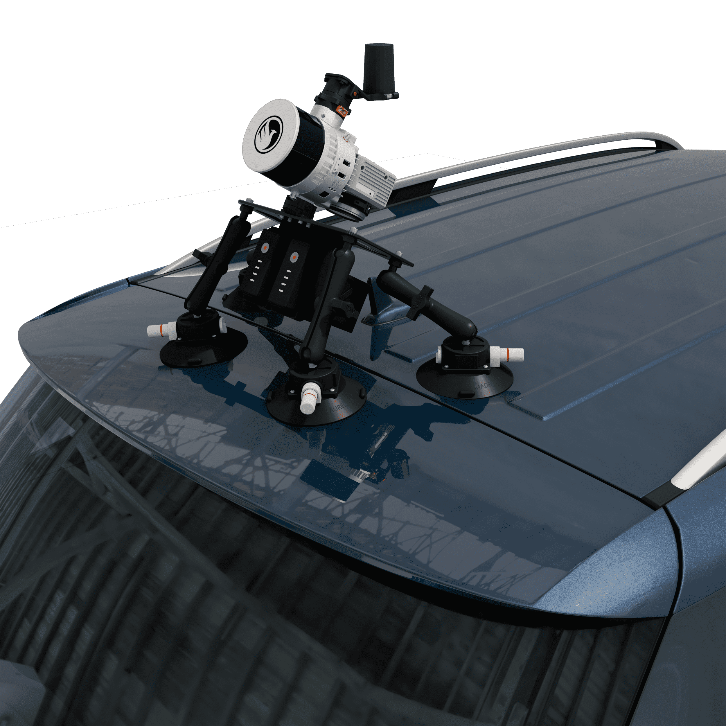
RECON-XT Now Mobile-Mapping Compatible with the Release of Our Universal Suction Mount!
The RECON-XT is a breakthrough technology in complete LiDAR solutions.
The system is capable of survey-grade accuracies, dense vegetation penetration, while retaining a minimalist, light-weight profile. While initially designed for seamless integration with the DJI M300 RTK airframe, Phoenix LiDAR Systems has made the RECON-XT compatible with a wide array of commercially available UAV.
Now, with the introduction of the Mobile Mapping Kit for RECON-XT, users can take their system from air to ground vehicle in a matter of minutes, giving operating teams the ability to access to more data, more applications, and more versatility than ever before.
When coupled with Phoenix Software LiDARMill and Spatial Explorer software, users can take advantage of industry leading data processing functions that drive automated workflows, quality control, reporting, deliverables, and remote viewing capabilities to even the most novice of LiDAR users.
Mountings for SUV, Pickup or Backpack are available to suit your application, LiDAR no longer restricted to mounting on a UAV, without Insurance and expert UAV pilot the high risk of loss and crashing must be considered with a high value purchase?
If you’re looking for an accurate, fast, lightweight, and versatile LiDAR system that is dependable and easy to use, the RECON-XT is one of the best choices available. We invite you to take a look at the sample data here, and contact Elliott Enterprises for more information.
Phoenix – Complete LiDAR Solutions
The solution you need to meet the growing demands of your clients in varying industries, from mining to agriculture and construction to forestry.
- Survey-Grade (cm-level) accuracy with 130 m laser range
- Penetrates vegetation to produce accurate results
- Free online tutorials available; PLUS complete Acquisition/Post-Processing/Pilot/Certification training also available (fees may apply)
- Optional Upgrades: Ground vehicle & UAV mounts/accessories, service plans and much more
- External USB storage included; 256 GB of space for capturing data all day
For complete details, contact Elliott Enterprises for a quotation